Beyond the Map — Designing GIS to Help People Understand the Places They Live
Every project starts with a request. "We want people to be able to plan their own evacuation routes." "We have good 3D city data. But… what is it actually for?" "We want high school students to learn about their own city." Ask why, and the same thing surfaces each time: if all they needed was a route, OpenStreetMap and OSRM solved that years ago — what people lacked was an understanding of the place they live in. I thought I was designing GIS. People were asking for understanding.
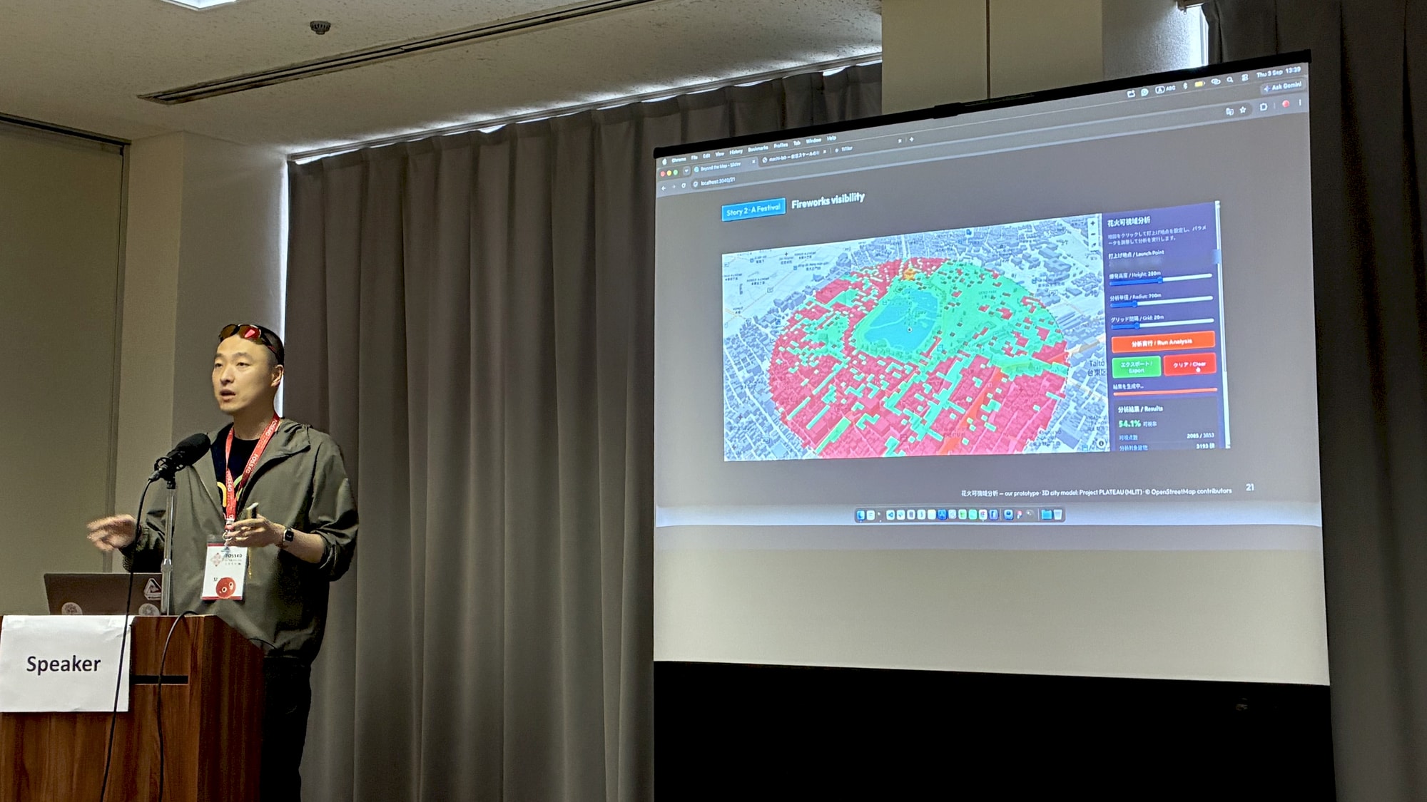
Three stories. A flood: first know your place, then make evacuation a game — in real life you get one chance to evacuate; in a game, you can fail a hundred times. A festival: the data didn't change, the technology didn't change, the question did — swap "what is this data for" with "who can see the fireworks", and the next questions (sunlight, noise, wind) start queuing up on their own. A classroom: high schoolers in Kumagaya spent one afternoon building their own buildings in their own city. Was that understanding? Honestly — I don't know.
What a lifetime knows: which house is sturdier, which neighbor's door will open. What the data knows: one meter of elevation difference, max flood depth, time until the water arrives. Being told < seeing < trying it yourself. Information is "I know what happened." Understanding is "I know why." Agency is "I can judge for myself."
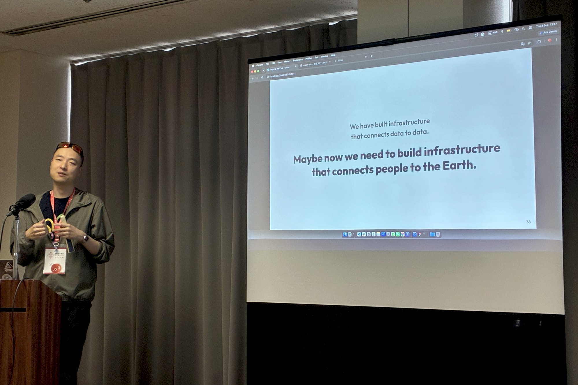
Two weeks before the talk, my own city issued a Level 4 evacuation alert — the river gauge by my door read almost four meters. That moment made it plain: the role of geospatial products is not to give people answers. It is to create the conditions in which people can discover how their world works. The street outside my door is the doorway to the whole planet — from the heat on my street, to a city hotter every year, to a sea warmer than thirty years ago. We have built infrastructure that connects data to data. Maybe now we need to build infrastructure that connects people to the Earth.
Build it for my neighbor.
---
layout: talk.njk
title_zh: "Beyond the Map —— 让人理解自己居住之地的 GIS 设计"
title_ja: "Beyond the Map — 住んでいる場所を理解するための GIS デザイン"
title_en: "Beyond the Map — Designing GIS to Help People Understand the Places They Live"
year: 2026
event: FOSS4G 2026
eventUrl: https://2026.foss4g.org/
role: speaker
location: 广岛
location_ja: 広島
location_en: Hiroshima, Japan
cover: /images/talks/foss4g-2026-beyond-the-map/cover.png
description: "Three stories — a flood, a festival, a classroom — about designing GIS for understanding rather than information. The role of geospatial products is not to give people answers, but to create the conditions in which people can discover how their world works."
slides: https://foss4g.surreal.red
workTags:
  - talk
---

<div class="gallery">
  <img src="/images/talks/foss4g-2026-beyond-the-map/on-stage.jpg" alt="FOSS4G 2026 広島・讲台上,屏幕上是「connects people to the Earth」">
  <img src="/images/talks/foss4g-2026-beyond-the-map/fireworks-demo.jpg" alt="FOSS4G 2026 広島・现场演示烟花可视域分析">
</div>

<div lang="zh">

每个项目都始于一个请求。「想让居民自己规划避难路线」「我们有很好的 3D 城市数据,但它到底有什么用?」「想让高中生了解自己的城市」。追问一句为什么就会发现:如果只是要一条路线,OpenStreetMap 和 OSRM 多年前就解决了——人们缺的是对自己居住之地的理解。我以为我在设计 GIS,人们要的其实是理解。

讲了三个故事。一场洪水:先认识自己住的地方,然后把撤离做成游戏——现实里你只有一次撤离的机会,游戏里可以失败一百次。一场烟花:数据没变,技术也没变,只是把问题从「这份数据有什么用」换成「哪里能看见烟花」,接下来阳光、噪声、风的问题就自己排着队来了。一间教室:熊谷的高中生用一个下午,在自己的城市里搭起自己的建筑——那算是理解吗?说实话,我不知道。

住了三十年的人知道哪栋房子更结实、哪家邻居会开门;数据知道一米的高差、最大浸水深度、水什么时候到。被告知,不如亲眼看到;亲眼看到,不如亲手试过。信息是「我知道发生了什么」,理解是「我知道为什么」,能动性是「我能自己判断」。

演讲前两周,我住的柏市发布了 Level 4 避难警报,门口的水位计快到四米。那一刻我很清楚:地理空间产品的角色不是给人答案,而是创造条件,让人自己发现这个世界是怎么运作的。家门口那条街,是通往整个地球的门——从门前的酷热,到一年比一年热的城市,再到比三十年前更暖的海。我们已经建好了把数据连向数据的基础设施,也许现在该建的,是把人连向地球的基础设施。

Build it for my neighbor.

</div>

<div lang="ja">

どのプロジェクトも、ひとつの依頼から始まる。「住民が自分で避難ルートを立てられるように」「うちには良い 3D 都市データがある。でも……これは結局、何のためのものなのか」「高校生に自分のまちを知ってほしい」。なぜ?と一歩踏み込むと見えてくる。ルートだけが欲しいなら、OpenStreetMap と OSRM が何年も前に解決している——足りていなかったのは、自分の住む場所への理解だった。私は GIS をデザインしているつもりだった。人々が求めていたのは、理解だった。

3 つの物語を話した。洪水の話:まず自分の場所を知る。それから避難をゲームにする——現実では避難のチャンスは一度きりだが、ゲームなら百回失敗できる。花火の話:データも技術も何ひとつ変わっていない。「このデータは何の役に立つのか」という問いを「花火はどこから見えるのか」に替えただけで、日当たり、騒音、風と、次の問いが勝手に並びはじめた。教室の話:熊谷の高校生たちが、ひとつの午後で自分のまちに自分の建物を建てた——あれは理解だったのか? 正直、わからない。

三十年住んだ人は、どの家が頑丈で、どの隣人がドアを開けてくれるかを知っている。データは、1 m の高低差と、最大浸水深と、水が届くまでの時間を知っている。教えられるより、目で見るほうがいい。目で見るより、自分で試すほうがいい。情報は「何が起きたかを知っている」。理解は「なぜかを知っている」。エージェンシーは「自分で判断できる」。

登壇の 2 週間前、私の住む柏でレベル 4 の避難警報が出た。近くの橋の水位計は 4 m 近くまで来ていた。あのとき、はっきりわかった。地理空間プロダクトの役割は、人に答えを渡すことではない。人が自分の世界の仕組みを自分で発見できる、その条件をつくることだ。家の前の通りは、地球全体への入口になる——玄関先の暑さから、年々暑くなる自分の街へ、そして三十年前より暖かい海へ。私たちはデータとデータをつなぐインフラを作ってきた。そろそろ、人と地球をつなぐインフラを作る番かもしれない。

Build it for my neighbor.

</div>

<div lang="en">

Every project starts with a request. "We want people to be able to plan their own evacuation routes." "We have good 3D city data. But… what is it actually for?" "We want high school students to learn about their own city." Ask why, and the same thing surfaces each time: if all they needed was a route, OpenStreetMap and OSRM solved that years ago — what people lacked was an understanding of the place they live in. I thought I was designing GIS. People were asking for understanding.

Three stories. A flood: first know your place, then make evacuation a game — in real life you get one chance to evacuate; in a game, you can fail a hundred times. A festival: the data didn't change, the technology didn't change, the question did — swap "what is this data for" with "who can see the fireworks", and the next questions (sunlight, noise, wind) start queuing up on their own. A classroom: high schoolers in Kumagaya spent one afternoon building their own buildings in their own city. Was that understanding? Honestly — I don't know.

What a lifetime knows: which house is sturdier, which neighbor's door will open. What the data knows: one meter of elevation difference, max flood depth, time until the water arrives. Being told < seeing < trying it yourself. Information is "I know what happened." Understanding is "I know why." Agency is "I can judge for myself."

Two weeks before the talk, my own city issued a Level 4 evacuation alert — the river gauge by my door read almost four meters. That moment made it plain: the role of geospatial products is not to give people answers. It is to create the conditions in which people can discover how their world works. The street outside my door is the doorway to the whole planet — from the heat on my street, to a city hotter every year, to a sea warmer than thirty years ago. We have built infrastructure that connects data to data. Maybe now we need to build infrastructure that connects people to the Earth.

Build it for my neighbor.

</div>